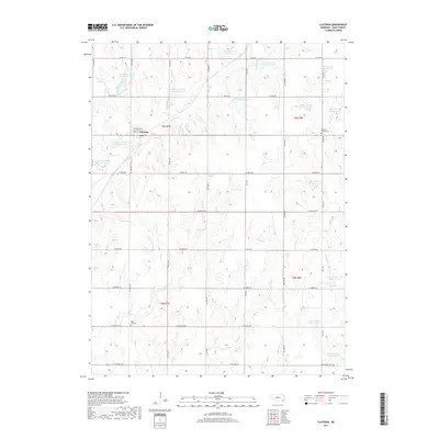
2017 Map of Clatonia
USGS Topo · Published 2017About this map
Clatonia serves as the primary hub in this corner of Gage County, where a grid of rural roads connects the surrounding agricultural lands. The landscape is defined by an extensive water management system featuring numerous numbered reservoirs like Clatonia Creek Reservoir 7-A and Indian Creek Reservoir 3-A, which help manage the drainage of the many local waterways. These streams, including Clatonia Cr, Soap Cr, and Snake Cr, weave through the terrain, indicating a complex network of prairie drainage. Genealogists and local historians can locate burial grounds such as Highland Center Cem and Rose Hill Cem, which stand as markers of the area's early settlement families. The map also records the rural landscape's transition through smaller tributaries like Possum Cr and various water control structures such as Little Indian Creek Reservoir 15.
Find a feature on this map
43 named features on this map. Tap any name to fly to it.
Don’t see what you’re looking for? This feature index may not catch every label — zoom into the map to look around manually.
Map Details
Editions of this 2017 Clatonia Map
This is the sole edition of this map. No revisions or reprints were ever made.
Other maps of this area

1897 · Lincoln
USGS Topo · 1:125,000

1955 · Lincoln
USGS Topo · 1:250,000

1957 · Lincoln
USGS Topo · 1:250,000

1957 · Plymouth
USGS Topo · 1:24,000

1957 · Clatonia
USGS Topo · 1:24,000

1957 · Beatrice West
USGS Topo · 1:24,000

1957 · Wilber
USGS Topo · 1:24,000

1957 · Beatrice East
USGS Topo · 1:24,000

1958 · Lincoln
USGS Topo · 1:250,000

1964 · Cortland
USGS Topo · 1:24,000