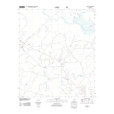
2010 Map of Clawson
USGS Topo · Published 2010About this map
Pollok and Clawson anchor this rural landscape in northern Angelina County, where a complex network of local roads such as McKnight Rd and Rifle Rd connects small communities and family landholdings. The terrain is defined by the wandering course of the Angelina River and its many tributaries, including Bodan Creek and Jack Creek. The map reveals a high density of small cemeteries, such as Gann Cemetery and Poskey Cemetery, which reflect the generations of local families who settled these woods. In the northeast, the hydraulic landscape is shaped by Bayou Loco and Bonaldo Creek, which feed into the marshy expanse near The Island. These features, combined with sites like Clear Lake Dam, illustrate the critical relationship between the region's hydrology and its community structure during the early 21st century.
Find a feature on this map
60 named features on this map. Tap any name to fly to it.
Don’t see what you’re looking for? This feature index may not catch every label — zoom into the map to look around manually.
Map Details
Editions of this 2010 Clawson Map
This is the sole edition of this map. No revisions or reprints were ever made.
Other maps of this area

1949 · Lufkin
USGS Topo · 1:62,500

1949 · Clawson
USGS Topo · 1:24,000

1949 · Lufkin
USGS Topo · 1:24,000

1949 · Keltys
USGS Topo · 1:24,000

1950 · Keltys
USGS Topo · 1:24,000

1950 · Lufkin
USGS Topo · 1:24,000

1950 · Clawson
USGS Topo · 1:24,000

1950 · Redland
USGS Topo · 1:24,000

1951 · Wells
USGS Topo · 1:24,000

1951 · Wells SW
USGS Topo · 1:24,000