
1949 Map of Clawson
USGS Topo · Published 1966About this map
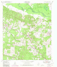
The Angelina River meanders along the northern boundary of this 1940s landscape, marking the border between Nacogdoches and Angelina counties. This rural stretch of East Texas is defined by the St Louis Southwestern railroad line, which anchors several small communities and loading points across the terrain. Small settlements like Pollok, Central, and Clawson are connected by a network of local roads and an extensive underground pipe line system. The presence of the Pollok Sch and several family-named burial sites, such as the Pollok Cem and Poskey Cem, points to a well-established community of timber and agricultural families. Much of the northern portion is occupied by the Angelina National Forest, where the topography is shaped by numerous tributaries like Bernaldo Creek and Loco Bayou. This map provides a detailed look at the local geography just after the war, before the expansion of modern infrastructure in the region.
Find a feature on this map
26 named features on this map. Tap any name to fly to it.
Don’t see what you’re looking for? This feature index may not catch every label — zoom into the map to look around manually.
Map Details
Editions of this 1949 Clawson Map
3 editions found
Other maps of this area

1949 · Lufkin
USGS Topo · 1:62,500

1949 · Lufkin
USGS Topo · 1:24,000

1949 · Keltys
USGS Topo · 1:24,000

1950 · Keltys
USGS Topo · 1:24,000

1950 · Lufkin
USGS Topo · 1:24,000

1950 · Clawson
USGS Topo · 1:24,000

1950 · Redland
USGS Topo · 1:24,000

1951 · Wells
USGS Topo · 1:24,000

1951 · Wells SW
USGS Topo · 1:24,000

1952 · Douglass
USGS Topo · 1:62,500