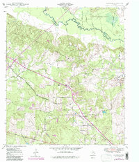
1949 Map of Clawson
USGS Topo · Published 1980About this map
The Angelina River meanders along the northern boundary of this East Texas terrain, marking the divide between Angelina Co and Nacogdoches Co. Much of the northeast corner is occupied by the Angelina National Forest, where the river is joined by the Loco Bayou and Alazan Bayou near a prominent landform known as The Island. This landscape reflects a mid-century rural economy defined by small crossroads settlements and timber resources, with the St Louis Southwestern railroad providing the primary industrial corridor through Pollok, Central, and Clawson. Local family history is well-preserved through several small burial grounds, including the Gann Cem near Central and the Poskey Cem and Newman Cem further south. The presence of an Underground Pipe Line and scattered Gravel Pit sites indicates the early expansion of regional utility and resource extraction infrastructure during this era.
Find a feature on this map
28 named features on this map. Tap any name to fly to it.
Don’t see what you’re looking for? This feature index may not catch every label — zoom into the map to look around manually.
Map Details
Editions of this 1949 Clawson Map
3 editions found
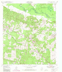
Other maps of this area

1949 · Lufkin
USGS Topo · 1:62,500

1949 · Clawson
USGS Topo · 1:24,000

1949 · Lufkin
USGS Topo · 1:24,000

1949 · Keltys
USGS Topo · 1:24,000

1950 · Keltys
USGS Topo · 1:24,000

1950 · Lufkin
USGS Topo · 1:24,000

1950 · Clawson
USGS Topo · 1:24,000

1950 · Redland
USGS Topo · 1:24,000

1951 · Wells
USGS Topo · 1:24,000

1951 · Wells SW
USGS Topo · 1:24,000