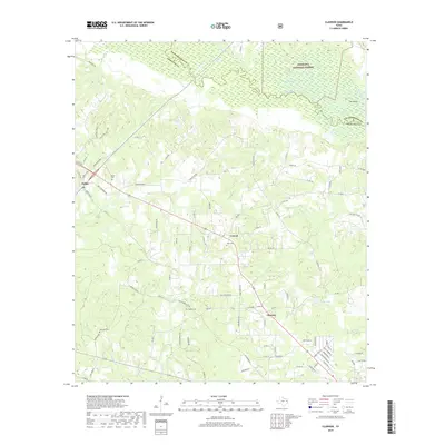
2019 Map of Clawson
USGS Topo · Published 2019About this map
The Angelina River meanders across the northern boundary of this quadrangle, defining the border between Nacogdoches and Angelina Counties. Much of this riparian landscape is protected within the Angelina National Forest, where the river creates complex waterways like Bayou Loco and Alazan Bayou, alongside a distinctive landform known as The Island. The terrain south of the river basin transitions into a network of creek drainages including Bonaldo Cr and Procella Cr, which have historically influenced the placement of local roads and communities.
Find a feature on this map
95 named features on this map. Tap any name to fly to it.
Don’t see what you’re looking for? This feature index may not catch every label — zoom into the map to look around manually.
Map Details
Editions of this 2019 Clawson Map
This is the sole edition of this map. No revisions or reprints were ever made.
Other maps of this area

1949 · Lufkin
USGS Topo · 1:62,500

1949 · Clawson
USGS Topo · 1:24,000

1949 · Lufkin
USGS Topo · 1:24,000

1949 · Keltys
USGS Topo · 1:24,000

1950 · Keltys
USGS Topo · 1:24,000

1950 · Lufkin
USGS Topo · 1:24,000

1950 · Clawson
USGS Topo · 1:24,000

1950 · Redland
USGS Topo · 1:24,000

1951 · Wells
USGS Topo · 1:24,000

1951 · Wells SW
USGS Topo · 1:24,000