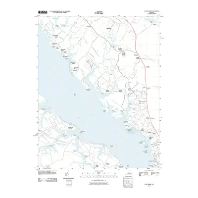
2010 Map of Clay Bank
USGS Topo · Published 2010About this map
The York River defines the geography of this Gloucester County region, where the tidal shoreline is broken by numerous creeks and marshy points. The legacy of colonial-era estates is visible in place names like Rosewell and the Old Rosewell Plantation Rd, which lead toward the historic water frontage. Inland, the map captures the transition from rural crossroads to residential communities, notably at Ordinary and White Marsh, where local post offices serve the surrounding neighborhoods. The southern portion of the sheet is dominated by the Cheatham Annex military installation and the complex hydrology of Penniman Lake and King Creek. Genealogists will find several significant burial sites, including the Abingdon Cemetery and Providence Cemetery, while navigators can trace the waterfront from Clay Bank Landing down to Gloucester Point.
Find a feature on this map
124 named features on this map. Tap any name to fly to it.
Don’t see what you’re looking for? This feature index may not catch every label — zoom into the map to look around manually.
Map Details
Editions of this 2010 Clay Bank Map
This is the sole edition of this map. No revisions or reprints were ever made.
Other maps of this area

1906 · Williamsburg
USGS Topo · 1:62,500

1907 · Yorktown
USGS Topo · 1:62,500

1907 · Hampton
USGS Topo · 1:62,500

1916 · Mathews
USGS Topo · 1:62,500

1917 · Mathews
USGS Topo · 1:62,500

1943 · Yorktown
USGS Topo · 1:62,500

1943 · Richmond
USGS Topo · 1:250,000

1944 · Yorktown
USGS Topo · 1:24,000

1944 · Harris Grove
USGS Topo · 1:24,000

1948 · Ware Neck
USGS Topo · 1:24,000