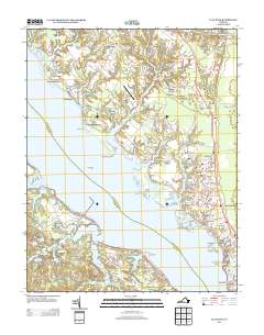
2013 Map of Clay Bank
USGS Topo · Published 2013About this map
York River frontage and tidal creeks define this landscape in Gloucester and York Counties during the early 21st century. The shoreline is marked by historic landings and modern communities, from Clay Bank and Hermitage in the north to Powhatan Shores and York River Pines further south. Significant maritime and military activity is centered around the Cheatham Annex naval facility, which occupies the southern bank near Penniman Spit and the Ringfield Picnic Area. Navigation in these waters is aided by Pages Rock Light, standing offshore from Blundering Point.
Find a feature on this map
88 named features on this map. Tap any name to fly to it.
Don’t see what you’re looking for? This feature index may not catch every label — zoom into the map to look around manually.
Map Details
Editions of this 2013 Clay Bank Map
This is the sole edition of this map. No revisions or reprints were ever made.
Other maps of this area

1906 · Williamsburg
USGS Topo · 1:62,500

1907 · Yorktown
USGS Topo · 1:62,500

1907 · Hampton
USGS Topo · 1:62,500

1916 · Mathews
USGS Topo · 1:62,500

1917 · Mathews
USGS Topo · 1:62,500

1943 · Yorktown
USGS Topo · 1:62,500

1943 · Richmond
USGS Topo · 1:250,000

1944 · Yorktown
USGS Topo · 1:24,000

1944 · Harris Grove
USGS Topo · 1:24,000

1948 · Ware Neck
USGS Topo · 1:24,000