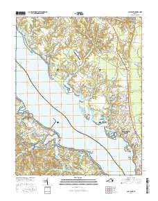
2016 Map of Clay Bank
USGS Topo · Published 2016About this map
Gloucester Point and the surrounding Tidewater landscape define this coastal reach where the York River narrows. The 2016 survey documents a region defined by its colonial legacy and water-bound geography, featuring the northern expanse of the Colonial National Historical Park and the low-lying Catlett Islands. Inshore, the map reveals a high density of local heritage sites, including the Abingdon Cem, Rosewell Memorial Garden, and Gloucester Field Cem, which serve as vital landmarks for family history. The settlement pattern follows the established corridors between White Marsh and Wicomico, with rural aviation represented by the New Quarter Farm Airport. From the marshlands of Black Swamp to the tidal reaches of Cedarbush Creek, the map details a landscape where traditional creek-side communities like Ordinary and Clay Bank persist alongside modern conservation areas.
Find a feature on this map
171 named features on this map. Tap any name to fly to it.
Don’t see what you’re looking for? This feature index may not catch every label — zoom into the map to look around manually.
Map Details
Editions of this 2016 Clay Bank Map
This is the sole edition of this map. No revisions or reprints were ever made.
Other maps of this area

1906 · Williamsburg
USGS Topo · 1:62,500

1907 · Yorktown
USGS Topo · 1:62,500

1907 · Hampton
USGS Topo · 1:62,500

1916 · Mathews
USGS Topo · 1:62,500

1917 · Mathews
USGS Topo · 1:62,500

1943 · Yorktown
USGS Topo · 1:62,500

1943 · Richmond
USGS Topo · 1:250,000

1944 · Yorktown
USGS Topo · 1:24,000

1944 · Harris Grove
USGS Topo · 1:24,000

1948 · Ware Neck
USGS Topo · 1:24,000