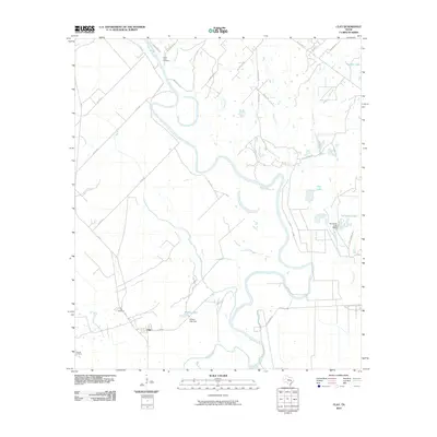
2010 Map of Clay
USGS Topo · Published 2010About this map
The Brazos River meanders heavily through this Burleson County landscape, creating a complex network of oxbows and riparian wetlands. The small settlement of Clay serves as a central point for the local agricultural community, while the presence of the Botts Ferry Cemetery, Clay Cemetery, and Thomas Cemetery provides valuable geographic markers for genealogists and local historians.
Find a feature on this map
38 named features on this map. Tap any name to fly to it.
Don’t see what you’re looking for? This feature index may not catch every label — zoom into the map to look around manually.
Map Details
Editions of this 2010 Clay Map
This is the sole edition of this map. No revisions or reprints were ever made.
Other maps of this area

1913 · Millican
USGS Topo · 1:31,680

1914 · Gay Hill
USGS Topo · 1:62,500

1914 · Navasota
USGS Topo · 1:62,500

1954 · Austin
USGS Topo · 1:250,000

1956 · Bryan
USGS Topo · 1:62,500

1956 · Carlos
USGS Topo · 1:62,500

1958 · Washington
USGS Topo · 1:24,000

1959 · Millican
USGS Topo · 1:24,000

1959 · Gay Hill
USGS Topo · 1:24,000

1959 · Clay
USGS Topo · 1:24,000