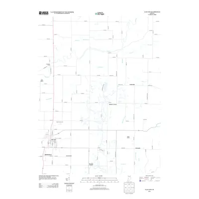
2013 Map of Clay City
USGS Topo · Published 2013About this map
The Eel River and its various tributaries, including Sixmile Cr and Sulphur Cr, dictate the layout of this western Indiana landscape. Established settlements like Clay City and Middlebury serve as the primary hubs in a region defined by an orderly grid of county roads, though older routes like W Towpath Rd hint at the historical transport corridors that once followed the river's path. Smaller rural communities such as Smithville, Hickory Corner, and Danville are scattered across the terrain, reflecting the agricultural and residential patterns of Clay County in the early 21st century.
Find a feature on this map
49 named features on this map. Tap any name to fly to it.
Don’t see what you’re looking for? This feature index may not catch every label — zoom into the map to look around manually.
Map Details
Editions of this 2013 Clay City Map
This is the sole edition of this map. No revisions or reprints were ever made.
Other maps of this area

1908 · Clay City
USGS Topo · 1:48,000

1908 · Bloomfield
USGS Topo · 1:62,500

1910 · Clay City
USGS Topo · 1:62,500

1938 · Coal City
USGS Topo · 1:24,000

1940 · Jasonville
USGS Topo · 1:24,000

1948 · Coal City
USGS Topo · 1:24,000

1950 · Arney
USGS Topo · 1:24,000
1953 · Coal City
USGS Topo · 1:24,000

1953 · Indianapolis
USGS Topo · 1:250,000

1956 · Indianapolis
USGS Topo · 1:250,000