
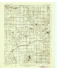
1910 Map of Clay City
USGS Topo · Published 1910About this map
Eel River and its complex drainage network define this west-central Indiana landscape, where the Wabash and Erie Canal (Abandoned) traces a quiet path through Perry and Harrison townships. The rail infrastructure of the early 1900s is prominent, with the Pennsylvania System, Vandalia RR, and Evansville and Indianapolis RR intersecting at key hubs like Clay City and Saline City.
Find a feature on this map
104 named features on this map. Tap any name to fly to it.
Don’t see what you’re looking for? This feature index may not catch every label — zoom into the map to look around manually.
Map Details
Editions of this 1910 Clay City Map
2 editions found
Other maps of this area

1908 · Clay City
USGS Topo · 1:48,000

1908 · Bloomfield
USGS Topo · 1:62,500

1938 · Coal City
USGS Topo · 1:24,000

1940 · Lewis
USGS Topo · 1:24,000

1940 · Jasonville
USGS Topo · 1:24,000

1941 · Seelyville
USGS Topo · 1:24,000

1943 · Hymera
USGS Topo · 1:24,000

1948 · Coal City
USGS Topo · 1:24,000

1950 · Arney
USGS Topo · 1:24,000

1950 · Rosedale
USGS Topo · 1:24,000