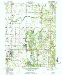
1963 Map of Clay City
USGS Topo · Published 1987About this map
Clay City serves as the primary population center on this mid-century survey, situated at a junction of rail lines and local roads. The landscape is defined by the winding course of the Eel River, which cuts through the northern half of the map, and the prominent topographic feature known as Sugar Ridge. In the southern portion, the smaller community of Middlebury is clearly delineated alongside several country churches and family-named cemeteries.
Find a feature on this map
44 named features on this map. Tap any name to fly to it.
Don’t see what you’re looking for? This feature index may not catch every label — zoom into the map to look around manually.
Map Details
Editions of this 1963 Clay City Map
This is the sole edition of this map. No revisions or reprints were ever made.
Other maps of this area

1908 · Clay City
USGS Topo · 1:48,000

1908 · Bloomfield
USGS Topo · 1:62,500

1910 · Clay City
USGS Topo · 1:62,500

1938 · Coal City
USGS Topo · 1:24,000

1940 · Jasonville
USGS Topo · 1:24,000

1948 · Coal City
USGS Topo · 1:24,000

1950 · Arney
USGS Topo · 1:24,000
1953 · Coal City
USGS Topo · 1:24,000

1953 · Indianapolis
USGS Topo · 1:250,000

1956 · Indianapolis
USGS Topo · 1:250,000