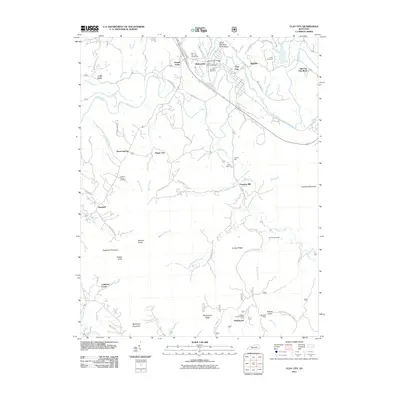
2011 Map of Clay City
USGS Topo · Published 2011About this map
Clay City serves as the hub of this Powell County region, where the Red River carves a distinctive path through the Kentucky landscape, most notably at the Great Red River North Bend. The transition from the valley floor to the elevated terrain of McKinney Mountain and Kaincaid Mountain defines the local geography. Industrial and social history is preserved through landmarks such as the Lewis Martin Grist Mill near Waltersville and the Vaughns Mill along Hardwick Creek. The map documents a network of rural communities, including Lone Oak, Happy Top, and Kimbrell, alongside several family and community burial grounds like Kennon Cemetery and Clark Cemetery. Farther south, the Marbleyard area and Marbleyard Ridge indicate a landscape shaped by both natural drainage like Rogers Fork and historic local industry near the Cottage Furnace Picnic Area.
Find a feature on this map
62 named features on this map. Tap any name to fly to it.
Don’t see what you’re looking for? This feature index may not catch every label — zoom into the map to look around manually.
Map Details
Editions of this 2011 Clay City Map
This is the sole edition of this map. No revisions or reprints were ever made.
Other maps of this area

1892 · Richmond
USGS Topo · 1:125,000

1892 · Beattyville
USGS Topo · 1:125,000

1897 · Richmond
USGS Topo · 1:125,000

1950 · Levee
USGS Topo · 1:24,000

1952 · Palmer
USGS Topo · 1:24,000

1952 · Clay City
USGS Topo · 1:24,000

1952 · Stanton
USGS Topo · 1:24,000

1952 · Means
USGS Topo · 1:24,000

1952 · Levee
USGS Topo · 1:24,000

1952 · Cobhill
USGS Topo · 1:24,000