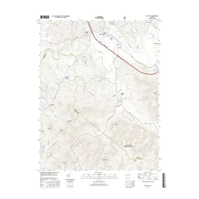
2016 Map of Clay City
USGS Topo · Published 2016About this map
Clay City sits at the northern edge of this terrain where the Great Red River North Bend carves through the landscape. This 2016 survey illustrates the transition from the river valley settlements like Waltersville and Powell Valley to the protected woodlands of the Daniel Boone National Forest in the south. The southern half of the map is defined by significant topographical landmarks such as Marbleyard Ridge, Combs Ridge, and the Buzzard Roost formation. To the west, the community of Spout Springs and the Powell Co Estill Co boundary line mark the intersection of local jurisdictions. Small hamlets like Vaughns Mill and Kimbrell are documented along the winding roads that follow the natural contours of the valley floors, providing a clear picture of modern land use and historical settlement patterns in this part of Kentucky.
Find a feature on this map
69 named features on this map. Tap any name to fly to it.
Don’t see what you’re looking for? This feature index may not catch every label — zoom into the map to look around manually.
Map Details
Editions of this 2016 Clay City Map
This is the sole edition of this map. No revisions or reprints were ever made.
Other maps of this area

1892 · Richmond
USGS Topo · 1:125,000

1892 · Beattyville
USGS Topo · 1:125,000

1897 · Richmond
USGS Topo · 1:125,000

1950 · Levee
USGS Topo · 1:24,000

1952 · Palmer
USGS Topo · 1:24,000

1952 · Clay City
USGS Topo · 1:24,000

1952 · Stanton
USGS Topo · 1:24,000

1952 · Means
USGS Topo · 1:24,000

1952 · Levee
USGS Topo · 1:24,000

1952 · Cobhill
USGS Topo · 1:24,000