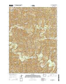
2014 Map of Clay Creek
USGS Topo · Published 2014About this map
Siuslaw River drainage systems define this section of the Coast Range at the border of Lane and Douglas Counties. The landscape is carved by a dense network of tributaries including Saleratus Creek, Wolf Creek, and Potato Patch Creek, reflecting the steep, dissected terrain typical of western Oregon. While the area is dominated by timber management and Bureau of Land Management access roads like Siuslaw River Road and BLM 19-8-14, the Clay Creek Recreational Reservoir and Esmond Lake serve as key points of human activity and resource management. Historically significant named landforms like Letsom Mountain, Cougar Gulch, and Farman Flat provide specific locational data for researchers studying the geography and land-use patterns of the early twenty-first century.
Find a feature on this map
51 named features on this map. Tap any name to fly to it.
Don’t see what you’re looking for? This feature index may not catch every label — zoom into the map to look around manually.
Map Details
Editions of this 2014 Clay Creek Map
This is the sole edition of this map. No revisions or reprints were ever made.
Other maps of this area

1909 · Elmira
USGS Topo · 1:62,500

1922 · Elmira
USGS Topo · 1:62,500

1941 · Blachly
USGS Topo · 1:62,500

1942 · Elmira
USGS Topo · 1:62,500

1942 · Blachly
USGS Topo · 1:62,500

1942 · Crow
USGS Topo · 1:62,500

1942 · Roman Nose Mtn
USGS Topo · 1:62,500

1945 · Crow
USGS Topo · 1:62,500

1945 · Roman Nose Mtn
USGS Topo · 1:62,500

1953 · Salem
USGS Topo · 1:250,000