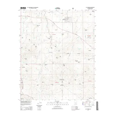
2014 Map of Clay Springs
USGS Topo · Published 2014About this map
Mogollon Plateau terrain dominates this portion of the high country, where the small settlements of Clay Springs and Pinedale are connected by State Hwy 260. The landscape is a network of named points and draws, including Rattlesnake Point and Thomas Draw, illustrating the complex drainage patterns of the Sitgreaves National Forest. Local infrastructure such as Pulpmill Rd and Limestone Rd suggests a history tied to timber and local resource extraction. Genealogists may find interest in the distinct labeling of Cemetery Rd and Old Cemetery Rd north of the Clay Springs townsite. The map also meticulously details numerous water sources essential for high-altitude ranching and survival, such as Sacket Tank, Indian Spring, and Red Rock Spring.
Find a feature on this map
88 named features on this map. Tap any name to fly to it.
Don’t see what you’re looking for? This feature index may not catch every label — zoom into the map to look around manually.
Map Details
Editions of this 2014 Clay Springs Map
This is the sole edition of this map. No revisions or reprints were ever made.
Other maps of this area

1886 · Holbrook
USGS Topo · 1:250,000

1893 · Holbrook
USGS Topo · 1:250,000

1954 · Holbrook
USGS Topo · 1:250,000

1957 · Holbrook
USGS Topo · 1:250,000

1958 · Holbrook
USGS Topo · 1:250,000

1960 · Holbrook
USGS Topo · 1:250,000

1961 · Clay Springs
USGS Topo · 1:62,500
1961 · Show Low
USGS Topo · 1:62,500

1961 · Cibecue
USGS Topo · 1:62,500
1970 · Cactus Flat
USGS Topo · 1:24,000