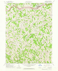
1964 Map of Claysville
USGS Topo · Published 1966About this map
The National Road and the Baltimore and Ohio railroad corridor dominate the northern landscape of Washington County in the mid-1960s, anchoring the borough of Claysville. This era reveals a transition from traditional agriculture toward resource extraction, evidenced by the numerous Gas Wells and Oil Wells peppered across the townships of Donegal, West Finley, and East Finley. The rural character remains preserved in small settlements like Coon Island and Good Intent, while the central portion of the map is dedicated to conservation within State Game Lands No 245. Genealogists will find significant detail in the placement of rural institutions, such as the East-West Finley Sch and several country churches including Fairmount Ch and Wheeling Hill Ch. The rugged drainage patterns of Robinson Fork and Templeton Fork define the movement of early roads and original property boundaries.
Find a feature on this map
41 named features on this map. Tap any name to fly to it.
Don’t see what you’re looking for? This feature index may not catch every label — zoom into the map to look around manually.
Map Details
Editions of this 1964 Claysville Map
Other maps of this area

1902 · Wheeling
USGS Topo · 1:62,500

1904 · Cameron
USGS Topo · 1:62,500

1905 · Rogersville
USGS Topo · 1:62,500

1907 · Claysville
USGS Topo · 1:62,500

1935 · Cameron
USGS Topo · 1:62,500

1935 · Wheeling
USGS Topo · 1:62,500

1942 · Cameron
USGS Topo · 1:62,500

1942 · Wheeling
USGS Topo · 1:62,500

1949 · Clarksburg
USGS Topo · 1:250,000

1951 · Canton
USGS Topo · 1:250,000
Featured Places
- East Finley Township, PA
- West Finley Township, PA
- Claysville, PA
- Coon Island, Donegal Township
- Buffalo Township, PA