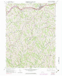
1964 Map of Claysville
USGS Topo · Published 1983About this map
The borough of Claysville serves as the focal point of this Washington County landscape, where the historic National Road and the Baltimore and Ohio railroad corridor follow the winding path of Dutch Fork. The topography is defined by the deep dissection of the Allegheny Plateau, with numerous Gas Wells and a Strip Mine indicating the region's long-standing reliance on resource extraction.
Find a feature on this map
40 named features on this map. Tap any name to fly to it.
Don’t see what you’re looking for? This feature index may not catch every label — zoom into the map to look around manually.
Map Details
Editions of this 1964 Claysville Map
Other maps of this area

1902 · Wheeling
USGS Topo · 1:62,500

1904 · Cameron
USGS Topo · 1:62,500

1905 · Rogersville
USGS Topo · 1:62,500

1907 · Claysville
USGS Topo · 1:62,500

1935 · Cameron
USGS Topo · 1:62,500

1935 · Wheeling
USGS Topo · 1:62,500

1942 · Cameron
USGS Topo · 1:62,500

1942 · Wheeling
USGS Topo · 1:62,500

1949 · Clarksburg
USGS Topo · 1:250,000

1951 · Canton
USGS Topo · 1:250,000
Featured Places
- East Finley Township, PA
- West Finley Township, PA
- Claysville, PA
- Coon Island, Donegal Township
- Buffalo Township, PA