
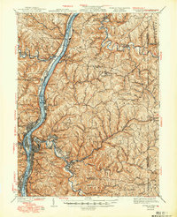
1942 Map of Wheeling
USGS Topo · Published 1942About this map
Wheeling serves as the industrial and cultural anchor of the Northern Panhandle, situated along a busy stretch of the Ohio River as it passes through West Virginia, Ohio, and Pennsylvania. This 1942 edition reflect revisions made in 1935, showing the region as a high-density corridor of river-fronting settlements like Warrenton, Rayland, and Windsor Heights. The river is dominated by the Pennsylvania RR and the Wheeling and Lake Erie RR, supporting a landscape of heavy industry and transport. Moving inland, the terrain transitions into the steep hills of Triadelphia and Richland districts, where the map documents a dense network of rural infrastructure. Significant educational and civic sites are noted, including the Teachers College at West Liberty and the County Home. The presence of Oglebay Park and Wheeling Park highlights the early development of managed recreation for the urban population of the Ohio Valley.
Find a feature on this map
150 named features on this map. Tap any name to fly to it.
Don’t see what you’re looking for? This feature index may not catch every label — zoom into the map to look around manually.
Map Details
Editions of this 1942 Wheeling Map
2 editions found
Other maps of this area

1901 · Cadiz
USGS Topo · 1:62,500

1902 · Wheeling
USGS Topo · 1:62,500

1903 · Cadiz
USGS Topo · 1:62,500

1904 · Steubenville
USGS Topo · 1:62,500

1904 · Cameron
USGS Topo · 1:62,500

1904 · Burgettstown
USGS Topo · 1:62,500

1905 · Rogersville
USGS Topo · 1:62,500

1905 · Clarington
USGS Topo · 1:62,500

1905 · St. Clairsville
USGS Topo · 1:62,500

1906 · Burgettstown
USGS Topo · 1:62,500