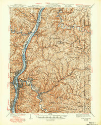
1942 Map of Wheeling
USGS Topo · Published 1949About this map
The Ohio River corridor serves as the industrial and transportation backbone of this tri-state region during the mid-1940s. Heavy rail lines including the Pennsylvania RR and Baltimore and Ohio RR hug the riverbanks, connecting bustling centers like Martins Ferry and Warwood to the interior coal and manufacturing markets. The map reveals a densely settled valley floor contrasted with the winding ridges of the Richland and Liberty districts.
Find a feature on this map
147 named features on this map. Tap any name to fly to it.
Don’t see what you’re looking for? This feature index may not catch every label — zoom into the map to look around manually.
Map Details
Editions of this 1942 Wheeling Map
2 editions found

Other maps of this area

1901 · Cadiz
USGS Topo · 1:62,500

1902 · Wheeling
USGS Topo · 1:62,500

1903 · Cadiz
USGS Topo · 1:62,500

1904 · Steubenville
USGS Topo · 1:62,500

1904 · Cameron
USGS Topo · 1:62,500

1904 · Burgettstown
USGS Topo · 1:62,500

1905 · Rogersville
USGS Topo · 1:62,500

1905 · Clarington
USGS Topo · 1:62,500

1905 · St. Clairsville
USGS Topo · 1:62,500

1906 · Burgettstown
USGS Topo · 1:62,500