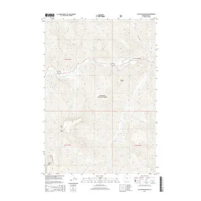
2015 Map of Clayton Mountain
USGS Topo · Published 2015About this map
The North Fork Shoshone River carves through the heart of this high-elevation landscape within the Shoshone National Forest, following a corridor that serves as a primary artery through the Absaroka Range. The map reveals a dramatic topography defined by towering peaks such as Clayton Mtn, Double Mtn, and the distinctive Post Point. This terrain is deeply dissected by a network of drainage systems, including the Clearwater Cr, Sweetwater Cr, and Elk Fork, which all feed toward the central river valley. Human presence is concentrated along the narrow riparian strip where the Sweetwater Creek Rd and other routes navigate the steep elevation changes. This 2015 survey provides a modern record of the land use and protected status of this Wyoming wilderness, documenting the intersection of primitive forest roads and the natural watercourses that define the region's geography.
Find a feature on this map
24 named features on this map. Tap any name to fly to it.
Don’t see what you’re looking for? This feature index may not catch every label — zoom into the map to look around manually.
Map Details
Editions of this 2015 Clayton Mountain Map
This is the sole edition of this map. No revisions or reprints were ever made.
Other maps of this area

1893 · Ishawooa
USGS Topo · 1:125,000

1895 · Ishawooa
USGS Topo · 1:125,000

1896 · Crandall Creek
USGS Topo · 1:125,000

1899 · Crandall
USGS Topo · 1:125,000

1899 · Ishawooa
USGS Topo · 1:125,000

1955 · Cody
USGS Topo · 1:250,000

1956 · Sunlight Peak
USGS Topo · 1:62,500

1956 · Dead Indian Peak
USGS Topo · 1:62,500

1958 · Cody
USGS Topo · 1:250,000

1962 · Cody
USGS Topo · 1:250,000