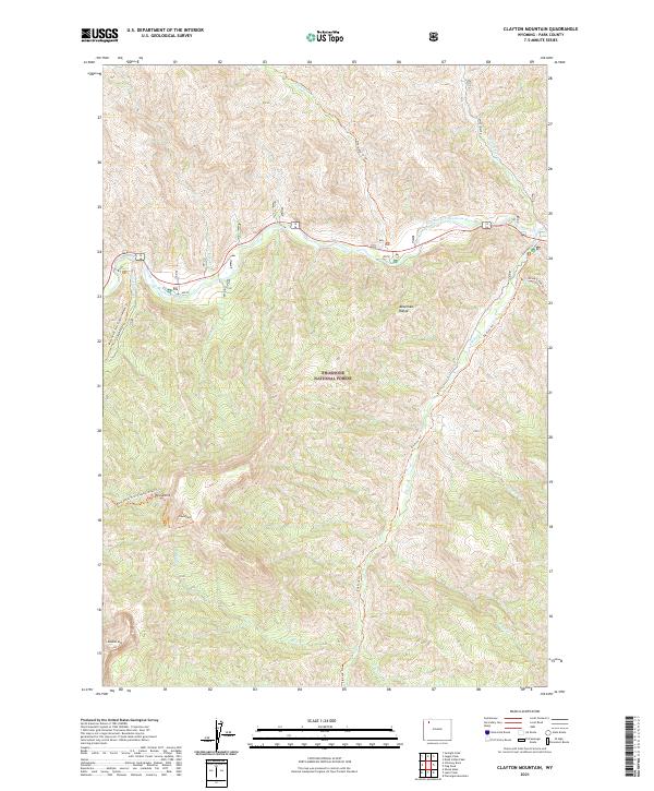
2021 Map of Clayton Mountain
USGS Topo · Published 2021About this map
The Shoshone National Forest dominates this section of the Absaroka Range, where high-elevation terrain is defined by the drainage network of the North Fork Shoshone River. The topography rises steeply to landmarks such as Clayton Mtn, Double Mtn, and the distinctive Post Point. This area serves as a critical corridor for backcountry travel, with established routes like the Blackwater Trail/Clayton Mount Trl and Elk Fork Trl providing access through the dense network of ridges and drainages. The river valley is a focal point for activity, hosting the Elk Fork Cg near the confluence of Elk Fork and the main river. Numerous seasonal and perennial streams including Clearwater Cr, Sweetwater Cr, and Frost Cr carve out the complex landscape, reflecting the primary role of water in shaping this protected wilderness.
Find a feature on this map
24 named features on this map. Tap any name to fly to it.
Don’t see what you’re looking for? This feature index may not catch every label — zoom into the map to look around manually.
Map Details
Editions of this 2021 Clayton Mountain Map
This is the sole edition of this map. No revisions or reprints were ever made.
Other maps of this area

1893 · Ishawooa
USGS Topo · 1:125,000

1895 · Ishawooa
USGS Topo · 1:125,000

1896 · Crandall Creek
USGS Topo · 1:125,000

1899 · Crandall
USGS Topo · 1:125,000

1899 · Ishawooa
USGS Topo · 1:125,000

1955 · Cody
USGS Topo · 1:250,000

1956 · Sunlight Peak
USGS Topo · 1:62,500

1956 · Dead Indian Peak
USGS Topo · 1:62,500

1958 · Cody
USGS Topo · 1:250,000

1962 · Cody
USGS Topo · 1:250,000