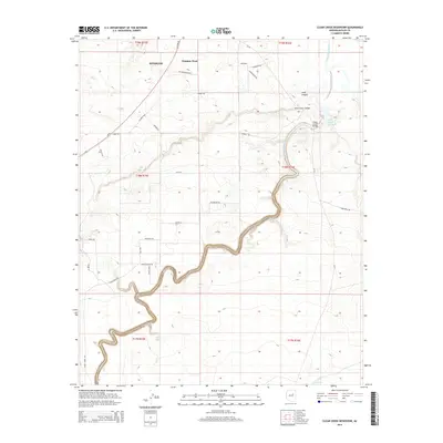
2014 Map of Clear Creek Reservoir
USGS Topo · Published 2014About this map
Winslow and its western outskirts at Winslow West anchor the northern reaches of this High Desert landscape just south of the Little Colorado River. The map highlights a significant transition from the organized grid of the city to the winding canyons and dry creek beds of the Colorado Plateau. A primary focal point is the Clear Creek Reservoir, where the water is spanned by the Clear Creek Bridge and fed by the deeply incised path of Clear Creek. To the north, Jacks Canyon cuts through the terrain, crossed by the Jacks Canyon Bridge. This survey details the modern infrastructure of the 2010s, showing a network of named local roads such as Reata Rd and Tumbleweed Rd that serve the outlying ranch lands and arid plains north of Corbet Tank.
Find a feature on this map
40 named features on this map. Tap any name to fly to it.
Don’t see what you’re looking for? This feature index may not catch every label — zoom into the map to look around manually.
Map Details
Editions of this 2014 Clear Creek Reservoir Map
This is the sole edition of this map. No revisions or reprints were ever made.
Other maps of this area

1883 · Tusayan
USGS Topo · 1:250,000

1886 · Tusayan
USGS Topo · 1:250,000

1886 · Holbrook
USGS Topo · 1:250,000

1893 · Holbrook
USGS Topo · 1:250,000

1947 · Flagstaff
USGS Topo · 1:250,000

1954 · Winslow
USGS Topo · 1:62,500

1954 · Winslow 4 SW
USGS Topo · 1:24,000

1954 · Winslow 4 SE
USGS Topo · 1:24,000

1954 · Flagstaff
USGS Topo · 1:250,000

1954 · Holbrook
USGS Topo · 1:250,000