
1954 Map of Winslow
USGS Topo · Published 1956About this map
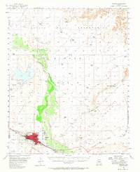
The Atchison Topeka and Santa Fe railroad serves as the industrial spine of the region, cutting through the growing community of Winslow during the mid-1950s. This survey illustrates the town's expansion toward Bushman Acres and the established Winslow Municipal Airport. The landscape is defined by the winding course of the Little Colorado River, which creates a strip of riparian life through the arid terrain of Tucker Mesa and Polacca Mesa. To the north, the boundary of the Navajo Indian Reservation meets the county line between Coconino and Navajo, marking a transition from municipal development to open range and traditional lands. Evidence of mid-century infrastructure is visible in landmarks like the Radio Sta (KVNC) and the Airway Beacon, reflecting the importance of communications and aviation in this high-desert hub.
Find a feature on this map
36 named features on this map. Tap any name to fly to it.
Don’t see what you’re looking for? This feature index may not catch every label — zoom into the map to look around manually.
Map Details
Editions of this 1954 Winslow Map
2 editions found
Other maps of this area

1883 · Tusayan
USGS Topo · 1:250,000

1886 · Tusayan
USGS Topo · 1:250,000

1886 · Holbrook
USGS Topo · 1:250,000

1893 · Holbrook
USGS Topo · 1:250,000

1947 · Flagstaff
USGS Topo · 1:250,000

1954 · Winslow 4 NW
USGS Topo · 1:24,000

1954 · Winslow 4 SW
USGS Topo · 1:24,000

1954 · Winslow 4 SE
USGS Topo · 1:24,000

1954 · Winslow 4 NE
USGS Topo · 1:24,000

1954 · Flagstaff
USGS Topo · 1:250,000