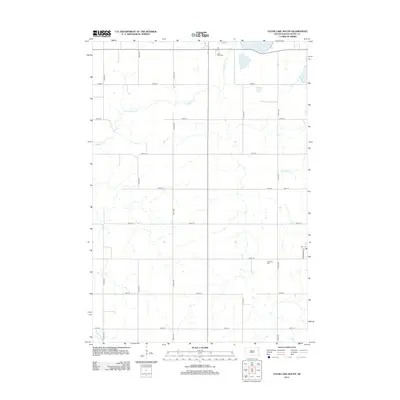
2012 Map of Clear Lake South
USGS Topo · Published 2012About this map
Clear Lake sits in the northeastern corner of this Deuel County landscape, an area defined by the headwaters and drainage patterns of the High Plains. Meandering waterways such as Hidewood Cr and N Br Cobb Cr carve through the agricultural grid, while Bullhead Run marks the southern reaches. The map reflects a classic rural Midwestern survey pattern, where section roads like 474th Ave and 185th St provide the primary structure for the landscape. For local historians, the placement of the Lake View Cem near the lake shore and Highland Cem further south provides essential markers of early settlement and community heritage. A single Po designation on Washington St hints at the civic center of the township, serving as a focal point for the surrounding farmsteads.
Find a feature on this map
21 named features on this map. Tap any name to fly to it.
Don’t see what you’re looking for? This feature index may not catch every label — zoom into the map to look around manually.
Map Details
Editions of this 2012 Clear Lake South Map
This is the sole edition of this map. No revisions or reprints were ever made.
Other maps of this area

1953 · Watertown
USGS Topo · 1:250,000

1958 · Watertown
USGS Topo · 1:250,000

1970 · Brandt
USGS Topo · 1:24,000

1970 · Bemis
USGS Topo · 1:24,000

1970 · Astoria
USGS Topo · 1:24,000

1970 · Clear Lake South
USGS Topo · 1:24,000

1970 · Estelline SE
USGS Topo · 1:24,000

1970 · Estelline NE
USGS Topo · 1:24,000

1970 · Toronto
USGS Topo · 1:24,000
1973 · Lake Francis
USGS Topo · 1:24,000