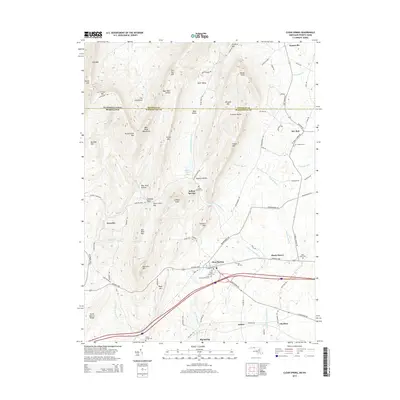
2014 Map of Clear Spring
USGS Topo · Published 2014About this map
Clear Spring and its surrounding agricultural valleys sit south of the Pennsylvania-Maryland border, where the terrain transitions from the ridge of Cove Mtn and Bear Pond Mountains into the rolling lowlands of Washington County. The National Pike serves as the primary east-west artery, connecting smaller communities like Shady Bower and Indian Springs. A dense concentration of cemeteries, including Rose Hill Cem, Saint Pauls Cem, and Clear Spring Peters Cem, suggests a long history of local settlement and family lineage in this corridor. The landscape is defined by the winding course of the Little Conococheague Creek and several mountain gaps, most notably Stone Cabin Gap and Dunns Gap. This survey documents a rural landscape where topographic features like The Punchbowl and Gillians Knob intersect with a well-established network of farm-to-market roads such as Broadfording Road.
Find a feature on this map
95 named features on this map. Tap any name to fly to it.
Don’t see what you’re looking for? This feature index may not catch every label — zoom into the map to look around manually.
Map Details
Editions of this 2014 Clear Spring Map
This is the sole edition of this map. No revisions or reprints were ever made.
Other maps of this area

1899 · Hancock
USGS Topo · 1:62,500

1900 · Mercersburg
USGS Topo · 1:62,500

1901 · Hancock
USGS Topo · 1:62,500

1902 · Mercersburg
USGS Topo · 1:62,500

1912 · Williamsport
USGS Topo · 1:62,500

1925 · Needmore
USGS Topo · 1:48,000

1935 · Needmore
USGS Topo · 1:62,500

1939 · Needmore
USGS Topo · 1:62,500

1942 · Hagerstown
USGS Topo · 1:125,000

1943 · Hagerstown
USGS Topo · 1:125,000