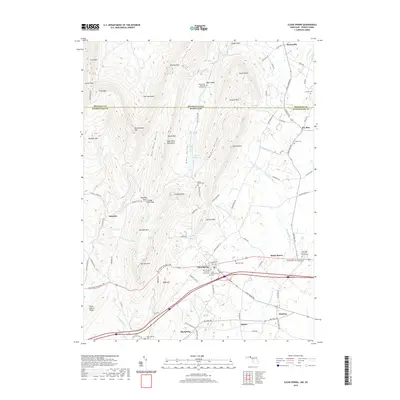
2019 Map of Clear Spring
USGS Topo · Published 2019About this map
Clear Spring serves as the focal point of this Maryland-Pennsylvania borderlands survey, where the valley floor meets the steep ascent of the Bear Pond Mountains. This area is defined by its deep agricultural and spiritual roots, evidenced by numerous rural burial grounds including the Saint Peters Lutheran Church Cem and the Union Bethel Cem. The landscape is a corridor of historical movement, with the Baltimore National Pike cutting through the center and the Interstate 70 corridor tracing old paths near Ashton and Charlton. To the north, the terrain becomes increasingly complex as it rises toward Two Top Mtn and Rickard Mtn, sheltering the secluded Blair Valley and its namesake Blairs Valley Lake. Notable geographic landmarks like The Punchbowl and Stone Cabin Gap reveal the difficult path of early settlers navigating these Appalachian ridges.
Find a feature on this map
103 named features on this map. Tap any name to fly to it.
Don’t see what you’re looking for? This feature index may not catch every label — zoom into the map to look around manually.
Map Details
Editions of this 2019 Clear Spring Map
This is the sole edition of this map. No revisions or reprints were ever made.
Other maps of this area

1899 · Hancock
USGS Topo · 1:62,500

1900 · Mercersburg
USGS Topo · 1:62,500

1901 · Hancock
USGS Topo · 1:62,500

1902 · Mercersburg
USGS Topo · 1:62,500

1912 · Williamsport
USGS Topo · 1:62,500

1925 · Needmore
USGS Topo · 1:48,000

1935 · Needmore
USGS Topo · 1:62,500

1939 · Needmore
USGS Topo · 1:62,500

1942 · Hagerstown
USGS Topo · 1:125,000

1943 · Hagerstown
USGS Topo · 1:125,000