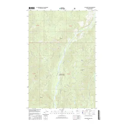
2017 Map of Clear West Peak
USGS Topo · Published 2017About this map
Snoqualmie National Forest dominates this high-altitude landscape, where the West Fork White River carves a deep valley between prominent landforms. The terrain is defined by dramatic elevations, featuring landmarks like Clear West Peak, Three Peaks, and the vertical walls of The Palisades. These peaks and ridges form a complex drainage network for numerous creeks including Hazzard Cr, Thirsty Cr, and Joe Cr.
Find a feature on this map
58 named features on this map. Tap any name to fly to it.
Don’t see what you’re looking for? This feature index may not catch every label — zoom into the map to look around manually.
Map Details
Editions of this 2017 Clear West Peak Map
This is the sole edition of this map. No revisions or reprints were ever made.
Other maps of this area

1913 · Cedar Lake
USGS Topo · 1:125,000

1924 · Mt Rainier
USGS Topo · 1:96,000

1928 · Mt Rainier
USGS Topo · 1:125,000

1950 · Yakima
USGS Topo · 1:250,000

1956 · Greenwater
USGS Topo · 1:62,500

1956 · Enumclaw
USGS Topo · 1:62,500

1957 · Wenatchee
USGS Topo · 1:250,000

1958 · Yakima
USGS Topo · 1:250,000

1961 · Yakima
USGS Topo · 1:250,000
1971 · Sunrise
USGS Topo · 1:24,000