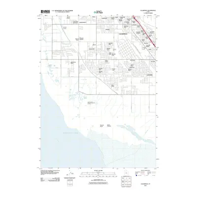
2011 Map of Clearfield
USGS Topo · Published 2011About this map
Great Salt Lake dominates the western edge of this 2011 survey, showing the shoreline where Farmington Bay meets the rapidly developing corridor of Davis County. The landscape is characterized by a dense grid of residential subdivisions and small holdings that have expanded across Syracuse, West Point, and Clinton. Of particular interest to local historians are the numerous named residential enclaves like Henry Oleson, Shimada Acres, and Equestrian Ranchettes, which reflect the transition from open agricultural land to suburban settlement. The industrial character of the region is anchored by the S Freeport Industrial Pkwy, while the Davis County Mosquito Abatement Airstrip and three significant burial grounds, including the West Point Memorial Cemetery, provide key genealogical and infrastructure landmarks.
Find a feature on this map
63 named features on this map. Tap any name to fly to it.
Don’t see what you’re looking for? This feature index may not catch every label — zoom into the map to look around manually.
Map Details
Editions of this 2011 Clearfield Map
This is the sole edition of this map. No revisions or reprints were ever made.
Other maps of this area

1885 · Salt Lake
USGS Topo · 1:250,000

1885 · Tooele Valley
USGS Topo · 1:250,000

1925 · Ft. Douglas
USGS Topo · 1:125,000

1928 · Ft. Douglas
USGS Topo · 1:125,000

1952 · Saltair NE
USGS Topo · 1:24,000

1952 · Farmington
USGS Topo · 1:24,000

1953 · Tooele
USGS Topo · 1:250,000

1954 · Antelope Island
USGS Topo · 1:24,000

1954 · Antelope Island North
USGS Topo · 1:24,000

1954 · Salt Lake City
USGS Topo · 1:250,000