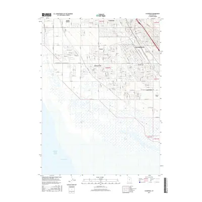
2017 Map of Clearfield
USGS Topo · Published 2017About this map
Syracuse and Clearfield anchor this 2017 landscape where the suburban grid of Davis County meets the transition to the Great Salt Lake. The map details a dense residential and industrial network, including the settlement of Anchorage and the small station area of Barnes, framed by the distant Wasatch Range to the east. Extensive wetland environments, including the West Layton Marshes and West Kaysville Marshes, dominate the southwestern portion of the sheet, providing a sharp contrast to the developed corridors of Layton, Clinton, and West Point. Local history is preserved in the placement of the West Point Cem, Syracuse Cem, and Clearfield City Cem. The geography highlights the critical interface between expanding urban development and the sensitive hydrological systems of Farmington Bay.
Find a feature on this map
88 named features on this map. Tap any name to fly to it.
Don’t see what you’re looking for? This feature index may not catch every label — zoom into the map to look around manually.
Map Details
Editions of this 2017 Clearfield Map
This is the sole edition of this map. No revisions or reprints were ever made.
Other maps of this area

1885 · Salt Lake
USGS Topo · 1:250,000

1885 · Tooele Valley
USGS Topo · 1:250,000

1925 · Ft. Douglas
USGS Topo · 1:125,000

1928 · Ft. Douglas
USGS Topo · 1:125,000

1952 · Saltair NE
USGS Topo · 1:24,000

1952 · Farmington
USGS Topo · 1:24,000

1953 · Tooele
USGS Topo · 1:250,000

1954 · Antelope Island
USGS Topo · 1:24,000

1954 · Antelope Island North
USGS Topo · 1:24,000

1954 · Salt Lake City
USGS Topo · 1:250,000