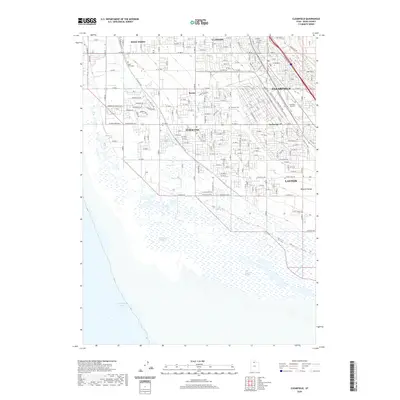
2020 Map of Clearfield
USGS Topo · Published 2020About this map
Syracuse and Clearfield anchor this residential and agricultural landscape on the eastern shore of the Great Salt Lake. The map illustrates a dense suburban grid transitioning into the ecologically sensitive West Layton Marshes and West Kaysville Marshes near Farmington Bay. For genealogists and local historians, several burial grounds are clearly marked, including the West Point Cem, Syracuse Cem, and Clearfield City Cem, providing essential points of reference for family research in Davis County. The eastern edge of the survey is defined by the rising slopes of the Wasatch Range, while the interior is crisscrossed by an extensive network of local roads such as W Gentile St and W Hillfield Rd. The presence of small settlements like Anchorage and Barnes reflects the continued growth and infill between the established municipalities of West Point, Clinton, and Layton.
Find a feature on this map
138 named features on this map. Tap any name to fly to it.
Don’t see what you’re looking for? This feature index may not catch every label — zoom into the map to look around manually.
Map Details
Editions of this 2020 Clearfield Map
This is the sole edition of this map. No revisions or reprints were ever made.
Other maps of this area

1885 · Salt Lake
USGS Topo · 1:250,000

1885 · Tooele Valley
USGS Topo · 1:250,000

1925 · Ft. Douglas
USGS Topo · 1:125,000

1928 · Ft. Douglas
USGS Topo · 1:125,000

1952 · Saltair NE
USGS Topo · 1:24,000

1952 · Farmington
USGS Topo · 1:24,000

1953 · Tooele
USGS Topo · 1:250,000

1954 · Antelope Island
USGS Topo · 1:24,000

1954 · Antelope Island North
USGS Topo · 1:24,000

1954 · Salt Lake City
USGS Topo · 1:250,000