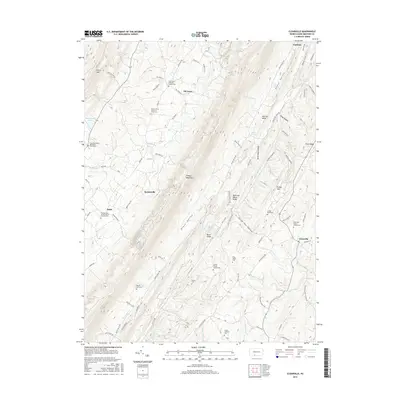
2016 Map of Clearville
USGS Topo · Published 2016About this map
Tussey Mountain and Polish Mtn dominate the landscape of central Bedford County, creating the narrow Black Valley that defines the local settlement pattern. Small communities such as Clearville and Koontzville are linked by rural routes like Chaneysville Rd, following the natural contours of the ridges. The map reveals a high density of family and congregational burial grounds, including the Peter O'Neal Cem, Pennel Farm Cem, and the Cornell Graveyard, which serve as vital markers of the area's ancestral landholdings.
Find a feature on this map
88 named features on this map. Tap any name to fly to it.
Don’t see what you’re looking for? This feature index may not catch every label — zoom into the map to look around manually.
Map Details
Editions of this 2016 Clearville Map
This is the sole edition of this map. No revisions or reprints were ever made.
Other maps of this area

1900 · Everett
USGS Topo · 1:62,500

1902 · Everett
USGS Topo · 1:62,500

1908 · Bedford
USGS Topo · 1:62,500

1910 · Bedford
USGS Topo · 1:62,500

1927 · Clearville
USGS Topo · 1:48,000

1927 · Hyndman
USGS Topo · 1:62,500

1931 · Clearville
USGS Topo · 1:62,500

1931 · Hyndman
USGS Topo · 1:62,500

1944 · Hyndman
USGS Topo · 1:62,500

1944 · Clearville
USGS Topo · 1:62,500
Featured Places
- Colerain Township, PA
- Bedford Township, PA
- West Providence Township, PA
- Clearville, Monroe Township
- Monroe Township, PA