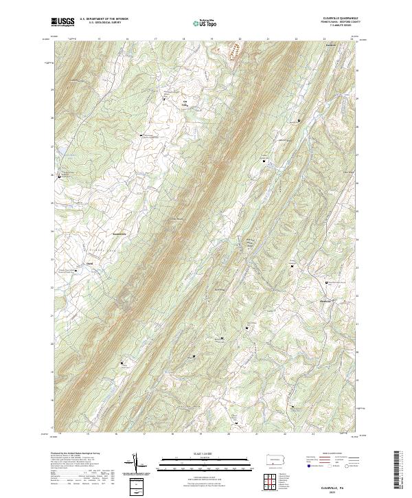
2023 Map of Clearville
USGS Topo · Published 2023About this map
Friends Cove and the surrounding ridges of Bedford County define this landscape, where small agricultural settlements like Clearville and Koontzville are linked by a network of rural roads. The area is characterized by long, parallel mountain ridges including Tussey Mountain and Warrior Ridge, which channel water into drainages like Black Valley Creek and Milk and Water Creek. For those researching local lineages, the map is remarkably dense with family-named landmarks and small burial grounds. Genealogists will find the Wilson Weimer Family Cem, Peter O'Neal Cem, and the Cornell Graveyard tucked into the hills. These sites, alongside local congregations like Saint Mark Lutheran Church and the Bethel Frame Church, reflect the deep-rooted community history established along the Mid State Trail and the banks of Cove Creek.
Find a feature on this map
101 named features on this map. Tap any name to fly to it.
Don’t see what you’re looking for? This feature index may not catch every label — zoom into the map to look around manually.
Map Details
Editions of this 2023 Clearville Map
This is the sole edition of this map. No revisions or reprints were ever made.
Other maps of this area

1900 · Everett
USGS Topo · 1:62,500

1902 · Everett
USGS Topo · 1:62,500

1908 · Bedford
USGS Topo · 1:62,500

1910 · Bedford
USGS Topo · 1:62,500

1927 · Clearville
USGS Topo · 1:48,000

1927 · Hyndman
USGS Topo · 1:62,500

1931 · Clearville
USGS Topo · 1:62,500

1931 · Hyndman
USGS Topo · 1:62,500

1944 · Hyndman
USGS Topo · 1:62,500

1944 · Clearville
USGS Topo · 1:62,500
Featured Places
- Colerain Township, PA
- Bedford Township, PA
- Monroe Township, PA
- Snake Spring Township, PA
- Diehl, Colerain Township