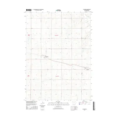
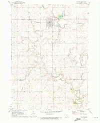
2015 Map of Cleghorn
USGS Topo · Published 2015About this map
Cleghorn and Meriden anchor this agricultural section of Cherokee County, Iowa, as it appeared in the mid-2010s. The landscape is defined by the regular grid of township and range lines, with the northwestern corner including a reach of the W Fork Little Sioux River. The area's water drainage network is complex, featuring numerous named branches like Whiskey Cr and Willow Cr that meander through the cultivated fields. For those researching local heritage, the map identifies specific community landmarks including Liberty Cem and Meriden Cem, which sit alongside the county highway system. The town of Cleghorn is shown at the junction of Hamilton Rd and Grace Ave, maintaining its historical footprint as a rural center amidst the surrounding prairie and farmland drainage basins of Mill Cr and Gere Cr.
Find a feature on this map
30 named features on this map. Tap any name to fly to it.
Don’t see what you’re looking for? This feature index may not catch every label — zoom into the map to look around manually.
Map Details
Editions of this 2015 Cleghorn Map
This is the sole edition of this map. No revisions or reprints were ever made.
Other maps of this area

1954 · Fort Dodge
USGS Topo · 1:250,000

1957 · Fort Dodge
USGS Topo · 1:250,000

1958 · Fort Dodge
USGS Topo · 1:250,000

1969 · Cleghorn
USGS Topo · 1:24,000

1969 · Fielding
USGS Topo · 1:24,000
1969 · Marcus
USGS Topo · 1:24,000

1969 · Cherokee South
USGS Topo · 1:24,000
1969 · Granville East
USGS Topo · 1:24,000
1969 · Quimby
USGS Topo · 1:24,000
1971 · Paullina
USGS Topo · 1:24,000