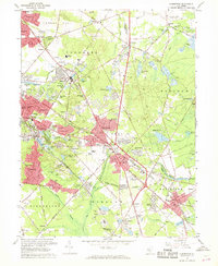
1967 Map of Clementon
USGS Topo · Published 1968About this map
The Pennsylvania Reading Seashore Lines provides a backbone for this portion of southern New Jersey, connecting the established communities of Berlin, West Berlin, and Clementon. This late-1960s landscape is characterized by its transition from industrial and agricultural roots to suburban expansion. To the north and west, new developments like Woodcrest Acres and Glendale appear alongside country clubs and schools, while the eastern and southern reaches retain a more traditional character.
Find a feature on this map
146 named features on this map. Tap any name to fly to it.
Don’t see what you’re looking for? This feature index may not catch every label — zoom into the map to look around manually.
Map Details
Editions of this 1967 Clementon Map
4 editions found
Other maps of this area

1888 · Mount Holly
USGS Topo · 1:62,500

1890 · Hammonton
USGS Topo · 1:62,500

1890 · Glassboro
USGS Topo · 1:62,500

1891 · Philadelphia
USGS Topo · 1:62,500

1894 · Hammonton
USGS Topo · 1:62,500

1894 · Mount Holly
USGS Topo · 1:62,500

1894 · Philadelphia
USGS Topo · 1:62,500

1896 · Philadelphia
USGS Topo · 1:62,500

1898 · Glassboro
USGS Topo · 1:62,500

1898 · Philadelphia
USGS Topo · 1:62,500