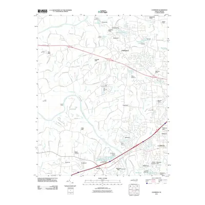
2010 Map of Clemmons
USGS Topo · Published 2010About this map
The Yadkin River defines the western edge of this landscape, winding past the community of Yadkin Valley and framing a region transitioning from rural estates to organized residential developments. The area between Lewisville and Clemmons is marked by a high density of private water features and small-scale dams, including the Lasater Mill Pond Dam and the unique tiered system of the Fred Bahnson Number One Lake and Fred Bahnson Number Two Lake. This reliance on small impoundments like Conrad Lake and Shallowford Lakes illustrates the historical management of local drainage for recreation and private land use.
Find a feature on this map
116 named features on this map. Tap any name to fly to it.
Don’t see what you’re looking for? This feature index may not catch every label — zoom into the map to look around manually.
Map Details
Editions of this 2010 Clemmons Map
This is the sole edition of this map. No revisions or reprints were ever made.
Other maps of this area

1891 · Yadkinville
USGS Topo · 1:125,000

1893 · Statesville
USGS Topo · 1:125,000

1893 · Yadkinville
USGS Topo · 1:125,000

1950 · Winston-Salem West
USGS Topo · 1:24,000

1951 · Winston-Salem West
USGS Topo · 1:24,000

1951 · Rural Hall
USGS Topo · 1:24,000

1953 · Charlotte
USGS Topo · 1:250,000

1953 · Winston-Salem
USGS Topo · 1:250,000

1954 · Charlotte
USGS Topo · 1:250,000

1955 · Winston-Salem
USGS Topo · 1:250,000