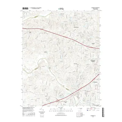
2016 Map of Clemmons
USGS Topo · Published 2016About this map
The Yadkin River defines the western edge of this suburban and rural landscape, marking the border where Forsyth County meets Yadkin and Davie Counties. In this mid-2010s perspective, the growing residential corridors of Lewisville and Clemmons are shown in high detail, illustrating the transition from traditional farming communities to established suburban hubs. Small private airstrips like Happy Bottom Airport and Whiteheart Farm Airport remain as holdovers of a more rural era, dotted among modern subdivisions and winding roads like Shallowford Rd.
Find a feature on this map
266 named features on this map. Tap any name to fly to it.
Don’t see what you’re looking for? This feature index may not catch every label — zoom into the map to look around manually.
Map Details
Editions of this 2016 Clemmons Map
This is the sole edition of this map. No revisions or reprints were ever made.
Other maps of this area

1891 · Yadkinville
USGS Topo · 1:125,000

1893 · Statesville
USGS Topo · 1:125,000

1893 · Yadkinville
USGS Topo · 1:125,000

1950 · Winston-Salem West
USGS Topo · 1:24,000

1951 · Winston-Salem West
USGS Topo · 1:24,000

1951 · Rural Hall
USGS Topo · 1:24,000

1953 · Charlotte
USGS Topo · 1:250,000

1953 · Winston-Salem
USGS Topo · 1:250,000

1954 · Charlotte
USGS Topo · 1:250,000

1955 · Winston-Salem
USGS Topo · 1:250,000