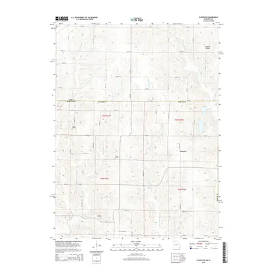
2015 Map of Cleopatra
USGS Topo · Published 2015About this map
Cleopatra and Clinton Center anchor this rural landscape straddling the Iowa-Missouri border. The terrain is defined by a dense network of southward-flowing waterways, most notably Little Medicine Cr and its western counterpart, the W Fork Medicine Cr. This section of the borderlands reflects a sparse settlement pattern dominated by agricultural section lines and a grid of rural roads like Cedar Rd and Aurora Rd. Family and community history is preserved in several small burial grounds scattered across the townships, including Laughlin Cemetery, Wilder Cemetery, and Lowery Cemetery. The map illustrates the persistent 19th-century land divisions of Mercer Co in Missouri and Wayne County in Iowa, showing how the drainage patterns of Little Muddy Cr and Muddy Cr dictated the placement of local thoroughfares and farmsteads.
Find a feature on this map
54 named features on this map. Tap any name to fly to it.
Don’t see what you’re looking for? This feature index may not catch every label — zoom into the map to look around manually.
Map Details
Editions of this 2015 Cleopatra Map
This is the sole edition of this map. No revisions or reprints were ever made.
Other maps of this area

1946 · Princeton
USGS Topo · 1:62,500

1948 · Princeton
USGS Topo · 1:62,500

1954 · Centerville
USGS Topo · 1:250,000

1957 · Centerville
USGS Topo · 1:250,000

1958 · Centerville
USGS Topo · 1:250,000

1964 · Ravanna
USGS Topo · 1:24,000

1964 · Woodland
USGS Topo · 1:24,000

1964 · Lucerne
USGS Topo · 1:24,000

1964 · Allerton
USGS Topo · 1:24,000

1964 · Cleopatra
USGS Topo · 1:24,000