
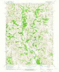
1964 Map of Ravanna
USGS Topo · Published 1965About this map
The settlement of Ravanna serves as the focal point of this mid-century rural landscape in Mercer County. The area is defined by a dendritic drainage pattern where Little Medicine Creek and Muddy Creek carve through the terrain, creating a network of ridges and timbered draws that dictate the placement of local homesteads and roads. To the south, West Honey Creek further shapes the topography, while the township boundaries of Somerset and Ravanna organize the rural sections.
Find a feature on this map
12 named features on this map. Tap any name to fly to it.
Don’t see what you’re looking for? This feature index may not catch every label — zoom into the map to look around manually.
Map Details
Editions of this 1964 Ravanna Map
This is the sole edition of this map. No revisions or reprints were ever made.
Other maps of this area

1946 · Princeton
USGS Topo · 1:62,500

1948 · Princeton
USGS Topo · 1:62,500

1954 · Centerville
USGS Topo · 1:250,000

1957 · Centerville
USGS Topo · 1:250,000

1958 · Centerville
USGS Topo · 1:250,000

1964 · Harris
USGS Topo · 1:24,000

1964 · Half Rock
USGS Topo · 1:24,000

1964 · Lucerne
USGS Topo · 1:24,000

1964 · Cleopatra
USGS Topo · 1:24,000
1964 · Powersville
USGS Topo · 1:24,000