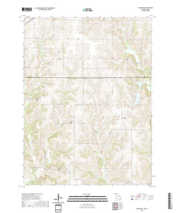
2021 Map of Cleopatra
USGS Topo · Published 2021About this map
The borderlands of northern Missouri and southern Iowa are defined by a network of seasonal streams and rural townships in this modern survey. The small settlement of Cleopatra serves as a central landmark within Mercer Co, positioned near several local family burial grounds including Laughlin Cem, Wilder Cem, and the Lowry Snyder Cem. The terrain is deeply dissected by numerous waterways such as Little Medicine Cr, W Fork Medicine Cr, and Little Muddy Cr, which dictate the placement of the grid-like road system.
Find a feature on this map
31 named features on this map. Tap any name to fly to it.
Don’t see what you’re looking for? This feature index may not catch every label — zoom into the map to look around manually.
Map Details
Editions of this 2021 Cleopatra Map
This is the sole edition of this map. No revisions or reprints were ever made.
Other maps of this area

1946 · Princeton
USGS Topo · 1:62,500

1948 · Princeton
USGS Topo · 1:62,500

1954 · Centerville
USGS Topo · 1:250,000

1957 · Centerville
USGS Topo · 1:250,000

1958 · Centerville
USGS Topo · 1:250,000

1964 · Ravanna
USGS Topo · 1:24,000

1964 · Woodland
USGS Topo · 1:24,000

1964 · Lucerne
USGS Topo · 1:24,000

1964 · Allerton
USGS Topo · 1:24,000

1964 · Cleopatra
USGS Topo · 1:24,000