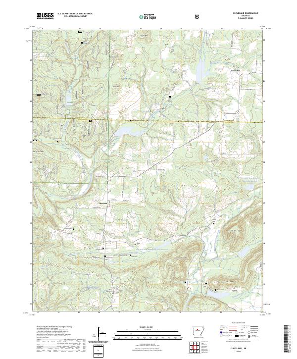
2024 Map of Cleveland
USGS Topo · Published 2024About this map
Cleveland sits at the heart of this North Arkansas landscape, where the headwaters of the Point Remove Creek system carve through the southern reaches of the Ozark National Forest. The map reveals a deeply etched topography of peaks and ridges, including Bass Mtn, Money Mtn, and the distinctive passage known as The Narrows. Family and community history is anchored by numerous burial sites scattered across the hills, such as Liberty Springs Cem, Upchurch Cem, and Campground Cem. Water management is a defining modern characteristic of the terrain, evidenced by the East Fork Point Remove Site Four Reservoir and East Fork Point Remove Site Three Reservoir. These reservoirs, along with various branches like Sucker Creek and Beardy Branch, illustrate how the drainage patterns shape the local road network, which transitions from state highways to remote forest routes like Wooden Bridge Rd and Bradford Lake Rd.
Find a feature on this map
80 named features on this map. Tap any name to fly to it.
Don’t see what you’re looking for? This feature index may not catch every label — zoom into the map to look around manually.
Map Details
Editions of this 2024 Cleveland Map
This is the sole edition of this map. No revisions or reprints were ever made.
Other maps of this area

1879 · Washington
USGS Topo · 1:62,500

1887 · Smyrna
USGS Topo · 1:62,500

1889 · Marshall #3
USGS Topo · 1:62,500

1892 · Marshall
USGS Topo · 1:125,000

1892 · Morrillton
USGS Topo · 1:125,000

1894 · Morrillton
USGS Topo · 1:125,000

1894 · Marshall
USGS Topo · 1:125,000

1901 · Marshall
USGS Topo · 1:125,000

1940 · Smyrna
USGS Topo · 1:62,500
1943 · Smyrna
USGS Topo · 1:62,500