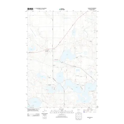
2013 Map of Cleveland
USGS Topo · Published 2013About this map
Glacial lakes and agricultural plots dominate the landscape of Le Sueur County, centered on the village of Cleveland. This 2013 survey illustrates a region defined by its water management, where a complex network of drainage systems like County Ditch Number Sixty and County Ditch Number Four navigate the low-lying terrain between larger bodies such as Lake Jefferson and Lake Washington. The map serves as a valuable resource for genealogical research, identifying several small burial grounds including the Wendelschafer Family Cem, Bluegrass Cem, and Meeker Cem. Beyond the primary residential cluster at Cleveland, the land is utilized for varied agricultural purposes, evidenced by the Cox Apple Orchard near Mud Lake and the Krenik Swine Farms north of Lake Henry. These features, along with the distinct peninsula of Cape Horn, highlight the enduring rural character of this Minnesota lake country.
Find a feature on this map
51 named features on this map. Tap any name to fly to it.
Don’t see what you’re looking for? This feature index may not catch every label — zoom into the map to look around manually.
Map Details
Editions of this 2013 Cleveland Map
This is the sole edition of this map. No revisions or reprints were ever made.
Other maps of this area

1950 · Mankato East
USGS Topo · 1:62,500

1951 · Mankato East
USGS Topo · 1:62,500

1953 · Saint Paul
USGS Topo · 1:250,000

1959 · Saint Paul
USGS Topo · 1:250,000

1965 · Cleveland
USGS Topo · 1:24,000
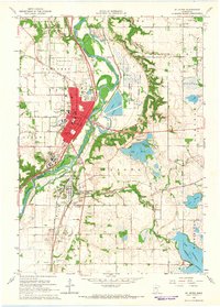
1965 · St Peter
USGS Topo · 1:24,000

1965 · Le Sueur
USGS Topo · 1:24,000

1965 · St Thomas
USGS Topo · 1:24,000

1966 · Cordova
USGS Topo · 1:24,000

1966 · Elysian
USGS Topo · 1:24,000