
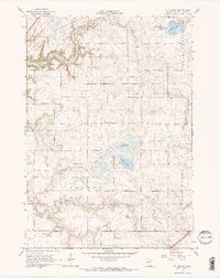
1965 Map of St Thomas
USGS Topo · Published 1966About this map
The agrarian landscape of Sharon and Derry Nane townships is defined by a dense network of nineteenth-century rural institutions and water management systems. Numerous burial grounds, including the Dresselville Cem, German Cem, and Sharon Cem, highlight the area's early settlement history and community foundations. The small hamlets of St Thomas and St Henry serve as local anchors, with the latter featuring its own parish church and cemetery.
Find a feature on this map
30 named features on this map. Tap any name to fly to it.
Don’t see what you’re looking for? This feature index may not catch every label — zoom into the map to look around manually.
Map Details
Editions of this 1965 St Thomas Map
2 editions found
Other maps of this area

1953 · Saint Paul
USGS Topo · 1:250,000

1957 · Belle Plaine
USGS Topo · 1:62,500

1957 · New Prague
USGS Topo · 1:62,500

1959 · Saint Paul
USGS Topo · 1:250,000

1965 · Cleveland
USGS Topo · 1:24,000
1965 · St Peter
USGS Topo · 1:24,000

1965 · Le Sueur
USGS Topo · 1:24,000

1966 · Cordova
USGS Topo · 1:24,000

1966 · Le Center
USGS Topo · 1:24,000
1981 · Belle Plaine South
USGS Topo · 1:24,000