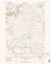
1965 Map of St. Thomas
USGS Topo · Published 1966About this map
St Thomas and St Henry anchor this rural landscape in Le Sueur County, showing the agricultural and religious character of central Minnesota in the mid-1960s. The map reveals a high density of rural burial grounds serving early immigrant communities, including the Lutheran Cem, German Cem, and Dresselville Cem. These sites, along with the Sharon Cem and Hillside Cem, provide essential data for genealogical research in the townships of Tyrone, Derry Nane, Sharon, and Lexington.
Find a feature on this map
22 named features on this map. Tap any name to fly to it.
Don’t see what you’re looking for? This feature index may not catch every label — zoom into the map to look around manually.
Map Details
Editions of this 1965 St. Thomas Map
2 editions found
Other maps of this area

1953 · Saint Paul
USGS Topo · 1:250,000

1957 · Belle Plaine
USGS Topo · 1:62,500

1957 · New Prague
USGS Topo · 1:62,500

1959 · Saint Paul
USGS Topo · 1:250,000

1965 · Cleveland
USGS Topo · 1:24,000
1965 · St Peter
USGS Topo · 1:24,000

1965 · Le Sueur
USGS Topo · 1:24,000

1965 · St Thomas
USGS Topo · 1:24,000

1966 · Cordova
USGS Topo · 1:24,000

1966 · Le Center
USGS Topo · 1:24,000