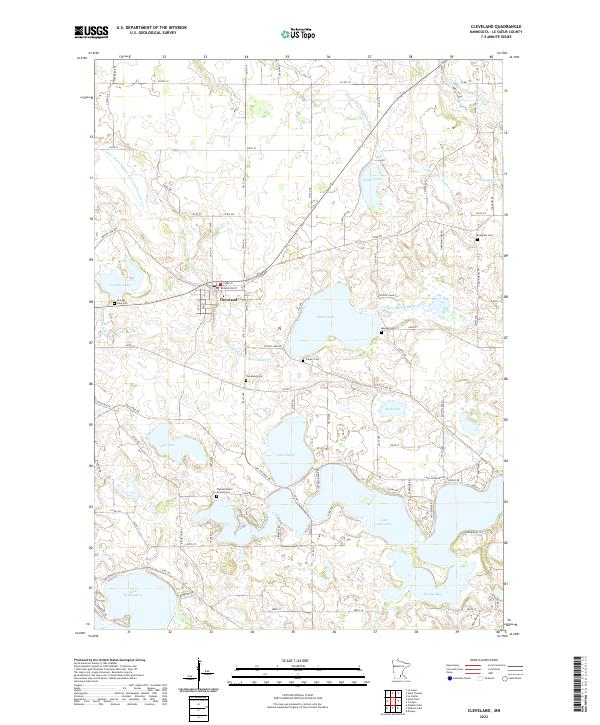
2022 Map of Cleveland
USGS Topo · Published 2022About this map
Cleveland serves as the central hub of this agricultural and lacustrine landscape in Le Sueur County. The town is situated at the intersection of Co Rd 46 and 10th St N, where the local post office Po is located. The surrounding terrain is defined by a complex network of glacial lakes and managed waterways, including the expansive Lake Jefferson, Lake Washington, and Lake Henry. These water bodies are interconnected by a system of man-made drainage, such as County Ditch Number Sixtyfive and County Ditch Number Four. For local historians and genealogists, the map provides a precise record of several burial sites, ranging from the Wendelschafer Family Cem near the southern lakes to the Calvary Cem and Cleveland Cem closer to the settlement, reflecting the deep-rooted family legacies of this rural Minnesota community.
Find a feature on this map
98 named features on this map. Tap any name to fly to it.
Don’t see what you’re looking for? This feature index may not catch every label — zoom into the map to look around manually.
Map Details
Editions of this 2022 Cleveland Map
This is the sole edition of this map. No revisions or reprints were ever made.
Other maps of this area

1950 · Mankato East
USGS Topo · 1:62,500

1951 · Mankato East
USGS Topo · 1:62,500

1953 · Saint Paul
USGS Topo · 1:250,000

1959 · Saint Paul
USGS Topo · 1:250,000

1965 · Cleveland
USGS Topo · 1:24,000
1965 · St Peter
USGS Topo · 1:24,000

1965 · Le Sueur
USGS Topo · 1:24,000

1965 · St Thomas
USGS Topo · 1:24,000

1966 · Cordova
USGS Topo · 1:24,000

1966 · Elysian
USGS Topo · 1:24,000