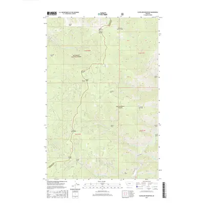
2017 Map of Cleveland Mountain
USGS Topo · Published 2017About this map
Bitterroot National Forest and Lolo National Forest converge in this high-elevation region of the Sapphire Mountains, where the boundary between Ravalli County and Granite County follows the prominent Bitterroot Divide. This topographic study reveals a landscape defined by sharp ridges and deep drainage systems, dominated by Cleveland Mountain and Cooney Ridge. The eastern portion of the map is shaped by the Rock Creek corridor, a significant drainage fed by numerous tributaries such as Cinnabar Creek and Welcome Creek.
Find a feature on this map
44 named features on this map. Tap any name to fly to it.
Don’t see what you’re looking for? This feature index may not catch every label — zoom into the map to look around manually.
Map Details
Editions of this 2017 Cleveland Mountain Map
This is the sole edition of this map. No revisions or reprints were ever made.
Other maps of this area

1903 · Bonner
USGS Topo · 1:125,000

1909 · Sapphire
USGS Topo · 1:125,000

1947 · Butte
USGS Topo · 1:250,000

1958 · Butte
USGS Topo · 1:250,000

1959 · Cleveland Mountain
USGS Topo · 1:62,500

1959 · Ravenna
USGS Topo · 1:62,500

1960 · Butte
USGS Topo · 1:250,000

1962 · Butte
USGS Topo · 1:250,000
1974 · Sawmill Saddle
USGS Topo · 1:24,000
1975 · Quigg Peak
USGS Topo · 1:24,000