
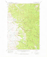
1959 Map of Cleveland Mountain
USGS Topo · Published 1961About this map
The Sapphire Mountains define the high country of this 1950s survey, where the Bitterroot Divide separates the drainages of the Bitterroot River from the Rock Creek system. This rugged intersection of the Lolo National Forest and Bitterroot National Forest shows a landscape defined by forestry and extraction. Mining activity is evident throughout the drainages, from the Whaley Mine in the north to numerous Placer Mines along Eightmile Creek.
Find a feature on this map
61 named features on this map. Tap any name to fly to it.
Don’t see what you’re looking for? This feature index may not catch every label — zoom into the map to look around manually.
Map Details
Editions of this 1959 Cleveland Mountain Map
2 editions found
Other maps of this area

1901 · Hamilton
USGS Topo · 1:125,000

1903 · Bonner
USGS Topo · 1:125,000

1909 · Sapphire
USGS Topo · 1:125,000

1912 · Missoula
USGS Topo · 1:125,000

1947 · Butte
USGS Topo · 1:250,000

1956 · Hamilton
USGS Topo · 1:250,000

1958 · Butte
USGS Topo · 1:250,000

1959 · Hamilton
USGS Topo · 1:250,000

1959 · Ravenna
USGS Topo · 1:62,500

1960 · Butte
USGS Topo · 1:250,000