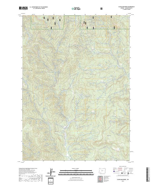
2023 Map of Cleveland Ridge
USGS Topo · Published 2023About this map
Cleveland Ridge serves as the central spine of this Jackson County landscape, dividing a complex network of drainages that flow into Evans Creek and the South Fork Cow Creek. To the north, the boundary of the Umpqua National Forest defines the high country, where the Cow Creek Trl traverses the area near Railroad Gap and Snowshoe Spring. The terrain is marked by prominent elevations including Board Mtn and Boswell Mtn in the south, while Buck Flat provides a rare break in the steep topography. A sparse network of forest roads such as E Fork Evans Creek Rd and Romine Creek Rd provides access to remote drainages like Walpole Creek and Paradise Creek, illustrating the logging and recreational infrastructure of the modern era.
Find a feature on this map
45 named features on this map. Tap any name to fly to it.
Don’t see what you’re looking for? This feature index may not catch every label — zoom into the map to look around manually.
Map Details
Editions of this 2023 Cleveland Ridge Map
This is the sole edition of this map. No revisions or reprints were ever made.
Other maps of this area

1891 · Ashland
USGS Topo · 1:250,000

1893 · Ashland
USGS Topo · 1:250,000

1897 · Ashland
USGS Topo · 1:250,000

1904 · Riddle
USGS Topo · 1:125,000

1943 · Trail
USGS Topo · 1:62,500

1944 · Tiller
USGS Topo · 1:62,500

1954 · Days Creek
USGS Topo · 1:62,500

1954 · Wimer
USGS Topo · 1:62,500

1955 · Medford
USGS Topo · 1:250,000

1957 · Medford
USGS Topo · 1:250,000