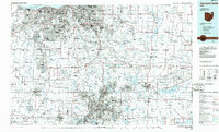
1986 Map of Cleveland South
USGS Topo · Published 1986About this map
The industrial corridor between Akron and Cleveland defines this mid-1980s landscape, illustrating the dense suburban expansion and massive transportation network of Northeast Ohio. Centered on the winding Cuyahoga River, the map highlights the newly established Cuyahoga Valley National Recreation Area, preserving a significant green belt between these major urban centers. Further east, the sprawling Ravenna Arsenal and various large-scale water projects like Michael J. Kirwan Reservoir and La Due Reservoir suggest the regional importance of infrastructure and defense. This planimetric record captures the region’s evolution from its heavy industrial roots, represented by the Conrail and Erie Lackawanna RR lines, to a landscape increasingly dominated by higher education centers such as Kent State University and Hiram College.
Find a feature on this map
317 named features on this map. Tap any name to fly to it.
Don’t see what you’re looking for? This feature index may not catch every label — zoom into the map to look around manually.
Map Details
Editions of this 1986 Cleveland South Map
This is the sole edition of this map. No revisions or reprints were ever made.
Other maps of this area

1901 · Oberlin
USGS Topo · 1:62,500

1901 · Massillon
USGS Topo · 1:62,500

1901 · Canton
USGS Topo · 1:62,500

1901 · Wooster
USGS Topo · 1:62,500

1901 · Euclid
USGS Topo · 1:62,500

1902 · Berea
USGS Topo · 1:62,500

1903 · Massillon
USGS Topo · 1:62,500

1903 · Wooster
USGS Topo · 1:62,500

1903 · Cleveland
USGS Topo · 1:62,500

1903 · Canton
USGS Topo · 1:62,500