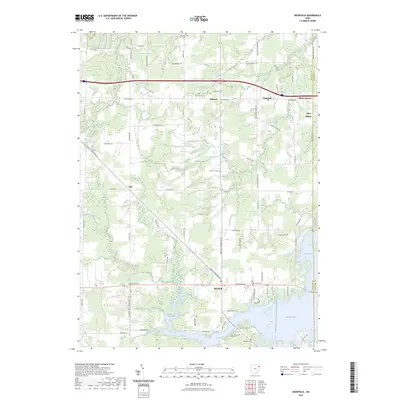
2023 Map of Deerfield
USGS Topo · Published 2023About this map
Berlin Lake dominates the southeast corner of this landscape, its irregular shoreline reaching north from the Portage and Mahoning county line. The terrain is a network of rural settlements and agricultural corridors, anchored by the crossroads of Deerfield and Palmyra. Historically significant for genealogists, the map preserves the locations of numerous family and community burial grounds, including Whippoorwill Cem, Robinson Cem, and Mottown Cem. Movement through the region is defined by long-standing transit routes such as the Cleve E Liverpool Rd and Tallmadge Rd, which connect smaller locales like Yale and Flicks Corners. The drainage of Willow Creek and Silver Creek provides a natural structure to the fields and woodlots that characterize this part of Northeast Ohio.
Find a feature on this map
59 named features on this map. Tap any name to fly to it.
Don’t see what you’re looking for? This feature index may not catch every label — zoom into the map to look around manually.
Map Details
Editions of this 2023 Deerfield Map
This is the sole edition of this map. No revisions or reprints were ever made.
Other maps of this area

1906 · Ravenna
USGS Topo · 1:62,500

1908 · Warren
USGS Topo · 1:62,500

1908 · Ravenna
USGS Topo · 1:62,500

1909 · Alliance
USGS Topo · 1:62,500

1909 · Lisbon
USGS Topo · 1:62,500

1950 · Cleveland
USGS Topo · 1:250,000

1951 · Canton
USGS Topo · 1:250,000

1952 · Lake Milton
USGS Topo · 1:24,000

1952 · Alliance
USGS Topo · 1:24,000

1952 · Damascus
USGS Topo · 1:24,000